


 AW: gewaltiger Klimaschwindel aufgeflogen !!
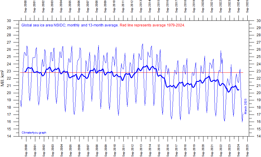
Graph showing monthly global sea ice extent since January 2000. The area covered by sea ice is defined as having at least 15% sea ice cover. The blue line shows monthly values, and the red line shows the simple running 13 month average. Data kindly provided by the National Snow and Ice Data Center (NSIDC).
[Links nur für registrierte Nutzer]
--------------------
Die Grafik wird wohl von der NSIDC nicht weiter geführt, sie ist wohl zu wenig alarmistisch?
Wer weiß mehr?

 Igno-ProllBank: Stalker ManfredM, et al...
 Mit Zitat antworten


 Es ist absolut möglich, dass jenseits der Wahrnehmung unserer Sinne ungeahnte Welten verborgen sind! (Albert Einstein)
